


ROCKVILLE Voting District, Kankakee County, Illinois
About
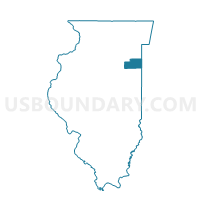
Outline

Summary
| Unique Area Identifier | 571718 |
| Name | ROCKVILLE Voting District |
| County | Kankakee County |
| State | Illinois |
| Area (square miles) | 36.60 |
| Land Area (square miles) | 36.45 |
| Water Area (square miles) | 0.15 |
| % of Land Area | 99.59 |
| % of Water Area | 0.41 |
| Latitude of the Internal Point | 41.24235760 |
| Longtitude of the Internal Point | -87.95546770 |
Maps


Graphs
Select a template below for downloading or customizing gragh for ROCKVILLE Voting District, Kankakee County, Illinois


Neighbors
Neighoring Voting District (by Name) Neighboring Voting District on the Map
- BOURBONNAIS 21 Voting District, Kankakee County, IL
- BOURBONNAIS 26 Voting District, Kankakee County, IL
- BOURBONNAIS 27 Voting District, Kankakee County, IL
- CUSTER Voting District, Will County, IL
- LIMESTONE 2 Voting District, Kankakee County, IL
- MANTENO TWP 1, Kankakee County, IL
- PEOTONE 2 Voting District, Will County, IL
- SALINA Voting District, Kankakee County, IL
- WESLEY 1 Voting District, Will County, IL
- WILTON Voting District, Will County, IL
Top 10 Neighboring County Subdivision (by Population) Neighboring County Subdivision on the Map
- Bourbonnais township, Kankakee County, IL (40,137)
- Manteno township, Kankakee County, IL (11,185)
- Limestone township, Kankakee County, IL (5,035)
- Peotone township, Will County, IL (4,431)
- Wesley township, Will County, IL (2,241)
- Custer township, Will County, IL (1,430)
- Salina township, Kankakee County, IL (1,396)
- Rockville township, Kankakee County, IL (879)
- Wilton township, Will County, IL (841)
Top 10 Neighboring Place (by Population) Neighboring Place on the Map
Top 10 Neighboring Elementary School District (by Population) Neighboring Elementary School District on the Map
Top 10 Neighboring Secondary School District (by Population) Neighboring Secondary School District on the Map
Top 10 Neighboring Unified School District (by Population) Neighboring Unified School District on the Map
- Manteno Community Unit School District 5, IL (12,432)
- Peotone Community Unit School District 207U, IL (11,012)
- Herscher Community Unit School District 2, IL (10,903)
- Wilmington Community Unit School District 209U, IL (9,403)
- Reed Custer Community Unit School District 255U, IL (9,368)
Top 10 Neighboring State Legislative District Lower Chamber (by Population) Neighboring State Legislative District Lower Chamber on the Map
Top 10 Neighboring State Legislative District Upper Chamber (by Population) Neighboring State Legislative District Upper Chamber on the Map
Top 10 Neighboring 111th Congressional District (by Population) Neighboring 111th Congressional District on the Map
Top 10 Neighboring Census Tract (by Population) Neighboring Census Tract on the Map
- Census Tract 105, Kankakee County, IL (7,142)
- Census Tract 106.01, Kankakee County, IL (5,406)
- Census Tract 104, Kankakee County, IL (4,982)
- Census Tract 8839.04, Will County, IL (4,431)
- Census Tract 103, Kankakee County, IL (3,854)
- Census Tract 8840.06, Will County, IL (2,241)
- Census Tract 102.01, Kankakee County, IL (1,903)
- Census Tract 8833.04, Will County, IL (1,774)
- Census Tract 8840.05, Will County, IL (1,430)
Top 10 Neighboring 5-Digit ZIP Code Tabulation Area (by Population) Neighboring 5-Digit ZIP Code Tabulation Area on the Map
- 60901, IL (37,157)
- 60914, IL (29,107)
- 60950, IL (12,168)
- 60481, IL (11,851)
- 60442, IL (9,924)
- 60913, IL (1,617)